
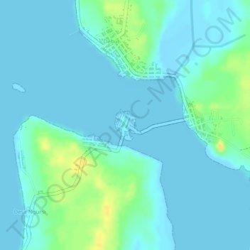
Batas Desa Dian Pulau Kec Kei Kecil Barat Kabupaten Maluku Tenggara topographic map
Interactive map
Click on the map to display elevation.
About this map
Name: Batas Desa Dian Pulau Kec Kei Kecil Barat Kabupaten Maluku Tenggara topographic map, elevation, terrain.
Average elevation: 6 m
Minimum elevation: 0 m
Maximum elevation: 27 m
Other topographic maps
Click on a map to view its topography, its elevation and its terrain.
Tanimbar Key
Indonesia > Moluccas > Maluku Tenggara
Tanimbar Key, Maluku Tenggara, Moluccas, Indonesia
Average elevation: 7 m
Desa Ngursi
Indonesia > Moluccas > Maluku Tenggara
Desa Ngursi, Maluku Tenggara, Moluccas, Indonesia
Average elevation: 6 m
Tual
Indonesia > Moluccas > Maluku Tenggara > Tual
Tual, Maluku Tenggara, Moluccas, Indonesia
Average elevation: 7 m