
Oram's Arbour topographic map
Interactive map
Click on the map to display elevation.
About this map
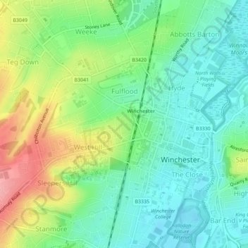
Name: Oram's Arbour topographic map, elevation, terrain.
Average elevation: 67 m
Minimum elevation: 29 m
Maximum elevation: 138 m
Other topographic maps
Click on a map to view its topography, its elevation and its terrain.
Harley Hill
United Kingdom > England > Hampshire > Winchester
Harley Hill, Winchester, Hampshire, England, SO21 1HL, United Kingdom
Average elevation: 88 m