
Thank you for supporting this site ❤️
Make a donation
Make a donation
Gear up for your next adventure:
As an Amazon Associate, this site earns from qualifying purchases at no extra cost to you.
Kurtkale topographic map
Click on the map to display elevation.
Thank you for supporting this site ❤️
Make a donation
Make a donation
Gear up for your next adventure:
As an Amazon Associate, this site earns from qualifying purchases at no extra cost to you.
About this map
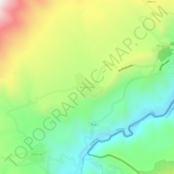
Name: Kurtkale topographic map, elevation, terrain.
Location: Kurtkale, Çıldır, Ardahan, Eastern Anatolia Region, Turkey (41.24847 43.10765 41.28847 43.14765)
Average elevation: 1,697 m
Minimum elevation: 1,350 m
Maximum elevation: 2,265 m
Thank you for supporting this site ❤️
Make a donation
Make a donation
Gear up for your next adventure:
As an Amazon Associate, this site earns from qualifying purchases at no extra cost to you.