
Jarmelo São Pedro topographic map
Interactive map
Click on the map to display elevation.
About this map
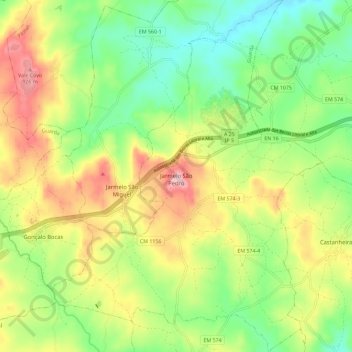
Name: Jarmelo São Pedro topographic map, elevation, terrain.
Location: Jarmelo São Pedro, Guarda, Portugal (40.54733 -7.17445 40.63482 -7.08586)
Average elevation: 800 m
Minimum elevation: 707 m
Maximum elevation: 932 m
Other topographic maps
Click on a map to view its topography, its elevation and its terrain.