
玉里鎮 topographic map
Interactive map
Click on the map to display elevation.
About this map
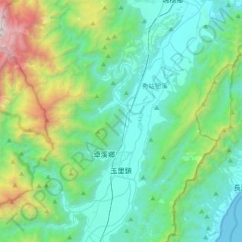
Name: 玉里鎮 topographic map, elevation, terrain.
Location: 玉里鎮, Hualien, 981, Taiwan (23.26144 121.26829 23.49583 121.44695)
Average elevation: 651 m
Minimum elevation: 0 m
Maximum elevation: 3,252 m
Other topographic maps
Click on a map to view its topography, its elevation and its terrain.