
Ajstrup topographic map
Interactive map
Click on the map to display elevation.
About this map
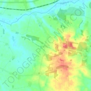
Name: Ajstrup topographic map, elevation, terrain.
Location: Ajstrup, Hjørring Kommune, Noord-Jutland, Denemarken (57.41619 10.12361 57.45619 10.16361)
Average elevation: 34 m
Minimum elevation: 16 m
Maximum elevation: 67 m