
La Esmeralda topographic map
Interactive map
Click on the map to display elevation.
About this map
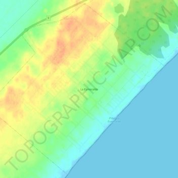
Name: La Esmeralda topographic map, elevation, terrain.
Location: La Esmeralda, Rocha, 27200, Uruguay (-34.18059 -53.72032 -34.13734 -53.66599)
Average elevation: 15 m
Minimum elevation: -1 m
Maximum elevation: 38 m