
Thank you for supporting this site ❤️
Make a donation
Make a donation
Gear up for your next adventure:
As an Amazon Associate, this site earns from qualifying purchases at no extra cost to you.
Mashava topographic map
Click on the map to display elevation.
Thank you for supporting this site ❤️
Make a donation
Make a donation
Gear up for your next adventure:
As an Amazon Associate, this site earns from qualifying purchases at no extra cost to you.
About this map
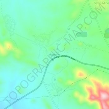
Name: Mashava topographic map, elevation, terrain.
Location: Mashava, Masvingo, Masvingo Province, Zimbabwe (-20.06542 30.46897 -20.02542 30.50897)
Average elevation: 1,051 m
Minimum elevation: 973 m
Maximum elevation: 1,273 m
Thank you for supporting this site ❤️
Make a donation
Make a donation
Gear up for your next adventure:
As an Amazon Associate, this site earns from qualifying purchases at no extra cost to you.