
Aosta topographic map
Interactive map
Click on the map to display elevation.
About this map
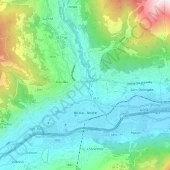
Name: Aosta topographic map, elevation, terrain.
Location: Aosta, Valle de Aosta, 11100, Italia (45.72626 7.23862 45.77265 7.34795)
Average elevation: 980 m
Minimum elevation: 537 m
Maximum elevation: 2,476 m