Geolocate

Freeport topographic map

Click on the map to display elevation.

About this map

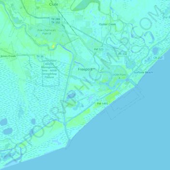
Name: Freeport topographic map, elevation, terrain.

Location: Freeport, Brazoria County, Texas, 77541, United States (28.86663 -95.45473 29.00697 -95.24373)

Average elevation: 2 m

Minimum elevation: -4 m

Maximum elevation: 21 m

Other topographic maps

Click on a map to view its topography, its elevation and its terrain.

Damon Mound

United States > Texas > Brazoria County > Damon

Average elevation: 28 m

Damon

United States > Texas > Brazoria County

Average elevation: 25 m

Damon

United States > Texas > Brazoria County

Average elevation: 25 m

Meridiana

United States > Texas > Brazoria County > Iowa Colony

Average elevation: 16 m

Rosharon

United States > Texas > Brazoria County

Average elevation: 16 m

Gear up for your next adventure:

🧺Fast-Dry Microfiber Towels - Large towels that pack down to the size of an orange
Altimeter Barometer Watches - Outdoor watches with built-in sensors to track altitude changes and weather shifts
📦Crushproof Equipment Cases - Safe transport for sensitive surveying and mapping instruments
🔋Rechargeable Batteries - Eco-friendly power for high-drain GPS units and flashlights
📟Satellite Messengers - Two-way satellite communication to stay in touch beyond the cellular grid

As an Amazon Associate, this site earns from qualifying purchases at no extra cost to you.