
Thank you for supporting this site ❤️
Make a donation
Make a donation
Gear up for your next adventure:
As an Amazon Associate, this site earns from qualifying purchases at no extra cost to you.
Koutiala topographic map
Click on the map to display elevation.
Thank you for supporting this site ❤️
Make a donation
Make a donation
Gear up for your next adventure:
As an Amazon Associate, this site earns from qualifying purchases at no extra cost to you.
About this map
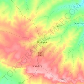
Name: Koutiala topographic map, elevation, terrain.
Location: Koutiala, Koutiala Cercle, Sikasso Region, Mali (12.22695 -5.62009 12.54695 -5.30009)
Average elevation: 366 m
Minimum elevation: 303 m
Maximum elevation: 429 m
Thank you for supporting this site ❤️
Make a donation
Make a donation
Gear up for your next adventure:
As an Amazon Associate, this site earns from qualifying purchases at no extra cost to you.