
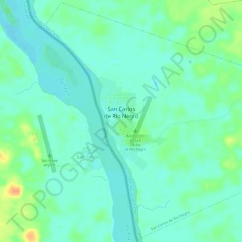
San Carlos de Río Negro topographic map
Interactive map
Click on the map to display elevation.
About this map
Name: San Carlos de Río Negro topographic map, elevation, terrain.
Average elevation: 86 m
Minimum elevation: 75 m
Maximum elevation: 113 m
Other topographic maps
Click on a map to view its topography, its elevation and its terrain.
Cerro de la Neblina
Venezuela > Amazonas > Municipio Autónomo Río Negro
Cerro de la Neblina, Parroquia Cocuy, Municipio Autónomo Río Negro, Amazonas, Venezuela
Average elevation: 1,017 m