Geolocate

Alanreed topographic map

Click on the map to display elevation.

About this map

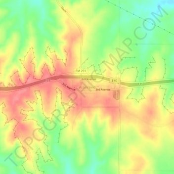
Name: Alanreed topographic map, elevation, terrain.

Location: Alanreed, Gray County, Texas, 79002, United States (35.19297 -100.75260 35.23297 -100.71260)

Average elevation: 904 m

Minimum elevation: 864 m

Maximum elevation: 936 m

Other topographic maps

Click on a map to view its topography, its elevation and its terrain.

Pampa

United States > Texas > Gray County

Average elevation: 983 m

Pampa

United States > Texas > Gray County

Average elevation: 983 m

Gear up for your next adventure:

Altimeter Watches - Watches with altitude tracking
🐍Snake Gaiters - Protection against snake bites
🩹Wilderness First Aid Kits - Comprehensive medical kits tailored for hiking and remote exploration
🏕️Camping Gear - Essential camping equipment
☀️Portable Solar Chargers - High-efficiency panels to hang on your backpack while walking

As an Amazon Associate, this site earns from qualifying purchases at no extra cost to you.