
Bonville Creek topographic map
Interactive map
Click on the map to display elevation.
About this map
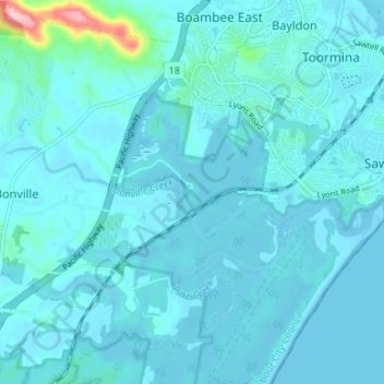
Name: Bonville Creek topographic map, elevation, terrain.
Average elevation: 14 m
Minimum elevation: -2 m
Maximum elevation: 187 m
Other topographic maps
Click on a map to view its topography, its elevation and its terrain.
Sawtell
Australia > New South Wales > Sawtell
Sawtell, Coffs Harbour City Council, New South Wales, 2452, Australia
Average elevation: 5 m