
Sandgate topographic map
Interactive map
Click on the map to display elevation.
About this map
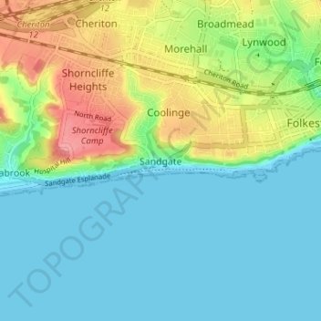
Name: Sandgate topographic map, elevation, terrain.
Location: Sandgate, Kent, South East, England, CT20 3RR, United Kingdom (51.05438 1.12871 51.09438 1.16871)
Average elevation: 24 m
Minimum elevation: 0 m
Maximum elevation: 81 m