
Miebach topographic map
Interactive map
Click on the map to display elevation.
About this map
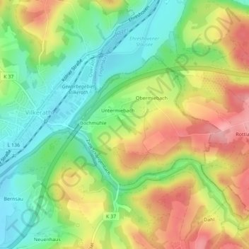
Name: Miebach topographic map, elevation, terrain.
Average elevation: 156 m
Minimum elevation: 97 m
Maximum elevation: 230 m
Other topographic maps
Click on a map to view its topography, its elevation and its terrain.
Wasser
Deutschland > Nordrhein-Westfalen > Overath > Wasser
Wasser, Overath, Rheinisch-Bergischer Kreis, Nordrhein-Westfalen, 51491, Deutschland
Average elevation: 165 m
Leyenhaus
Deutschland > Nordrhein-Westfalen > Overath > Leyenhaus
Leyenhaus, Overath, Rheinisch-Bergischer Kreis, Nordrhein-Westfalen, 51491, Deutschland
Average elevation: 166 m
Hufe
Deutschland > Nordrhein-Westfalen > Overath > Hufe
Hufe, Overath, Rheinisch-Bergischer Kreis, Nordrhein-Westfalen, 51491, Deutschland
Average elevation: 181 m