
Laulo topographic map
Interactive map
Click on the map to display elevation.
About this map
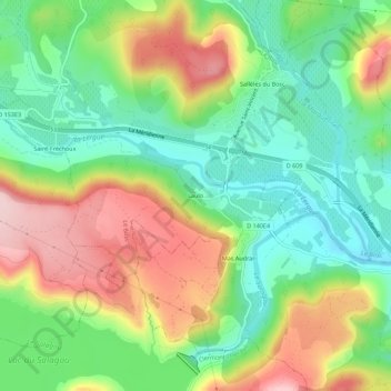
Name: Laulo topographic map, elevation, terrain.
Average elevation: 156 m
Minimum elevation: 63 m
Maximum elevation: 290 m
Other topographic maps
Click on a map to view its topography, its elevation and its terrain.
Saint-Fréchoux
France > Occitanie > Hérault > Le Bosc
Saint-Fréchoux, Le Bosc, Lodève, Hérault, Occitanie, France métropolitaine, 34700, France
Average elevation: 169 m