Geolocate

Pilar topographic map

Click on the map to display elevation.

About this map

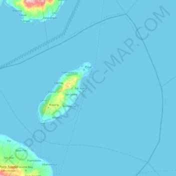
Name: Pilar topographic map, elevation, terrain.

Location: Pilar, Cebu, Central Visayas, 6048, Philippines (10.67833 124.42564 10.87814 124.66718)

Average elevation: 9 m

Minimum elevation: -1 m

Maximum elevation: 317 m

Other topographic maps

Click on a map to view its topography, its elevation and its terrain.

Biasong

Philippines > Cebu > Pilar

Average elevation: 56 m

Lanao

Philippines > Cebu > Pilar > Lanao

Average elevation: 35 m

Gear up for your next adventure:

🧢Wide Brim Sun Hats - Maximum coverage for the face and neck while out in the open
🔪Multitools - Compact tools for outdoor use
📍Handheld GPS - GPS devices for hiking and navigation
🏫Topographic World Globes - 3D physical relief globes to understand global geography
🔋Solar Power Banks - Charge your phone and GPS using the sun while deep in the bush

As an Amazon Associate, this site earns from qualifying purchases at no extra cost to you.