Geolocate

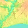
Turkey Point topographic map

Click on the map to display elevation.

About this map

Name: Turkey Point topographic map, elevation, terrain.

Location: Turkey Point, Norfolk County, Southwestern Ontario, Ontario, Canada (42.66881 -80.34920 42.70881 -80.30920)

Average elevation: 187 m

Minimum elevation: 171 m

Maximum elevation: 229 m

Other topographic maps

Click on a map to view its topography, its elevation and its terrain.

Deer Creek

Canada > Ontario > Norfolk County

Average elevation: 215 m

Deer Creek

Canada > Ontario > Norfolk County > Langton

Average elevation: 226 m

Bass Lake

Canada > Ontario > Norfolk County > Waterford

Average elevation: 236 m

Port Dover Beach

Canada > Ontario > Norfolk County > Port Dover

Average elevation: 180 m

Haldimand—Norfolk

Canada > Ontario > Norfolk County

Average elevation: 210 m

Haldimand—Norfolk

Canada > Ontario > Norfolk County

Average elevation: 210 m

Gear up for your next adventure:

🧤Thermal Hiking Gloves - Keep your hands warm and functional during high-altitude winter treks
📦Crushproof Equipment Cases - Safe transport for sensitive surveying and mapping instruments
🛌Sleeping Bags - Sleeping bags for outdoor camping
🥤Hydration Packs - Hydration systems for hiking
🎽Base Layers - Thermal base layers

As an Amazon Associate, this site earns from qualifying purchases at no extra cost to you.