
Overland Park topographic map
Interactive map
Click on the map to display elevation.
About this map
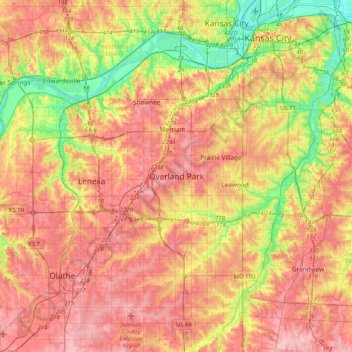
Name: Overland Park topographic map, elevation, terrain.
Location: Overland Park, Johnson County, Kansas, 66204, United States (38.81425 -94.84517 39.13425 -94.52517)
Average elevation: 288 m
Minimum elevation: 219 m
Maximum elevation: 343 m