Geolocate

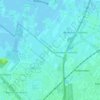
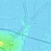
Waverveen topographic map

Click on the map to display elevation.

About this map

Name: Waverveen topographic map, elevation, terrain.

Location: Waverveen, De Ronde Venen, Utrecht, Netherlands (52.21641 4.85653 52.25372 4.93204)

Average elevation: -4 m

Minimum elevation: -8 m

Maximum elevation: 4 m

Other topographic maps

Click on a map to view its topography, its elevation and its terrain.

Amersfoortse Berg

Netherlands > Utrecht > Amersfoort

Average elevation: 19 m

Breedeveen

Netherlands > Utrecht > Leersum

Average elevation: 15 m

Palestina

Netherlands > Utrecht > Amersfoort

Average elevation: 2 m

Cabauw

Netherlands > Utrecht

Average elevation: -1 m

Amerongse Berg

Netherlands > Utrecht > Amerongen

Average elevation: 34 m

Eembrugge

Netherlands > Utrecht > Baarn

Average elevation: 1 m

Gear up for your next adventure:

🦘Outback Survival Gear - Essential gear for Australian outback
🔑Heavy Duty Carabiners - Secure gear to the outside of your pack for easy access
👖Convertible Hiking Trousers - Zip-off legs to adapt to changing temperatures throughout the day
🏕️Camping Gear - Essential camping equipment
🥤Hydration Packs - Hydration systems for hiking

As an Amazon Associate, this site earns from qualifying purchases at no extra cost to you.