Geolocate

Xiamen topographic map

Click on the map to display elevation.

About this map

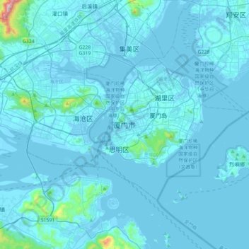
Name: Xiamen topographic map, elevation, terrain.

Location: Xiamen, Siming District, Xiamen, Fujian, 361000, China (24.32011 117.92535 24.64011 118.24535)

Average elevation: 29 m

Minimum elevation: -6 m

Maximum elevation: 874 m

Other topographic maps

Click on a map to view its topography, its elevation and its terrain.

Gulangyu

China > Fujian > Xiamen > Siming

Average elevation: 5 m

Gear up for your next adventure:

🪑Portable Backpacking Chairs - A comfortable seat for studying maps at the end of the day
☀️Portable Solar Chargers - High-efficiency panels to hang on your backpack while walking
🦟Heavy Duty Insect Repellent - Essential protection against flies, mozzies, and march flies
🥾Hiking Boots - Durable hiking boots for trails and rough terrain
🦘Outback Survival Gear - Essential gear for Australian outback

As an Amazon Associate, this site earns from qualifying purchases at no extra cost to you.