Geolocate

Wingham topographic map

Click on the map to display elevation.

About this map

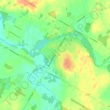
Name: Wingham topographic map, elevation, terrain.

Location: Wingham, North Huron, Huron County, Ontario, N0G 2W0, Canada (43.86625 -81.33275 43.90625 -81.29275)

Average elevation: 318 m

Minimum elevation: 298 m

Maximum elevation: 342 m

Gear up for your next adventure:

🧭Military Style Lensatic Compass - Durable sighting compasses for advanced land navigation and surveying
🧤Thermal Hiking Gloves - Keep your hands warm and functional during high-altitude winter treks
🎽Base Layers - Thermal base layers
🎒Ultralight Backpacks - Lightweight packs for long hikes
Altimeter Watches - Watches with altitude tracking

As an Amazon Associate, this site earns from qualifying purchases at no extra cost to you.