
San Luis topographic map
Interactive map
Click on the map to display elevation.
About this map
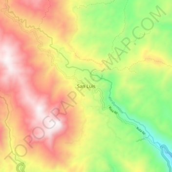
Name: San Luis topographic map, elevation, terrain.
Location: San Luis, Oriente, Antioquia, Colombia (6.00281 -75.03441 6.08281 -74.95441)
Average elevation: 1,155 m
Minimum elevation: 504 m
Maximum elevation: 1,784 m