
Huntersville topographic map
Interactive map
Click on the map to display elevation.
About this map
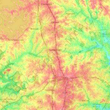
Name: Huntersville topographic map, elevation, terrain.
Location: Huntersville, Mecklenburg County, North Carolina, 28078, VS (35.35070 -80.96122 35.45508 -80.75294)
Average elevation: 226 m
Minimum elevation: 180 m
Maximum elevation: 264 m