
Neril topographic map
Interactive map
Click on the map to display elevation.
About this map
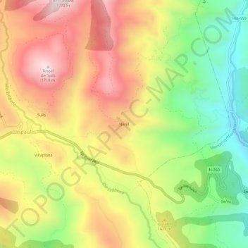
Name: Neril topographic map, elevation, terrain.
Location: Neril, Laspaúles, La Ribagorza, Huesca, Aragón, Spanje (42.45225 0.60039 42.49225 0.64039)
Average elevation: 1,381 m
Minimum elevation: 1,043 m
Maximum elevation: 1,716 m
Other topographic maps
Click on a map to view its topography, its elevation and its terrain.