
Juja topographic map
Click on the map to display elevation.
About this map
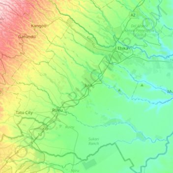
Name: Juja topographic map, elevation, terrain.
Location: Juja, Kiambu, Central Kenya, 01001, Kenya (-1.20543 36.87780 -1.00525 37.18732)
Average elevation: 1,539 m
Minimum elevation: 1,422 m
Maximum elevation: 1,856 m
Other topographic maps
Click on a map to view its topography, its elevation and its terrain.