
帕羊镇 topographic map
Interactive map
Click on the map to display elevation.
About this map
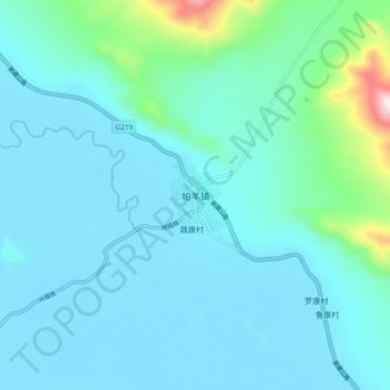
Name: 帕羊镇 topographic map, elevation, terrain.
Location: 帕羊镇, 仲巴县, 日喀则市, 西藏自治区, 中国 (30.00192 83.42780 30.08192 83.50780)
Average elevation: 4,647 m
Minimum elevation: 4,576 m
Maximum elevation: 5,133 m
Other topographic maps
Click on a map to view its topography, its elevation and its terrain.