Geolocate

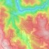
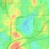
Wilson topographic map

Click on the map to display elevation.

About this map

Name: Wilson topographic map, elevation, terrain.

Location: Wilson, Perth, Western Australia, Australia (-32.03238 115.89758 -32.01230 115.92876)

Average elevation: 8 m

Minimum elevation: -7 m

Maximum elevation: 34 m

Western Australia trails, hiking, mountain biking, running and outdoor activities

Other topographic maps

Click on a map to view its topography, its elevation and its terrain.
Canning river

Australia > Western Australia > Perth

Average elevation: 293 m

Reabold Hill

Australia > Western Australia > Perth

Average elevation: 32 m

Mundaring Weir

Australia > Western Australia > Perth

Average elevation: 185 m

Adenia Lagoon

Australia > Western Australia > Perth

Average elevation: 9 m

Lake Gwelup

Australia > Western Australia > Perth

Average elevation: 25 m

Geo Lithgo Park

Australia > Western Australia > Perth

Average elevation: 28 m

Lake Claremont

Australia > Western Australia > Perth

Average elevation: 22 m

Mosman Beach

Australia > Western Australia > Perth

Average elevation: 9 m

Woodford Park

Australia > Western Australia > Perth

Average elevation: 11 m

Hatfield Park

Australia > Western Australia > Perth

Average elevation: 24 m

Brittania Reserve

Australia > Western Australia > Perth

Average elevation: 25 m

Alderley Park

Australia > Western Australia > Perth

Average elevation: 10 m

Bold Park

Australia > Western Australia > Perth

Average elevation: 34 m

Gear up for your next adventure:

🌿Flora and Fauna Field Guides - Identify the plants and animals you encounter on your route
🧊Insulated Stainless Steel Flasks - Keep water cold for 24 hours in the heat or coffee hot in the cold
🥾Hiking Shoes - Lightweight hiking shoes for day hikes
🎒3L Hydration Reservoirs - Hands-free drinking to stay hydrated on steep contour climbs
🧥Softshell Jackets - Flexible outdoor jackets

As an Amazon Associate, this site earns from qualifying purchases at no extra cost to you.