
구로구 topographic map
Interactive map
Click on the map to display elevation.
About this map
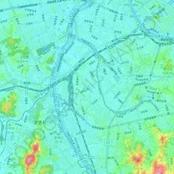
Name: 구로구 topographic map, elevation, terrain.
Location: 구로구, Seul, Coreia do Sul (37.47311 126.81303 37.51643 126.90315)
Average elevation: 28 m
Minimum elevation: -2 m
Maximum elevation: 191 m