
Teivas topographic map
Interactive map
Click on the map to display elevation.
About this map
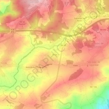
Name: Teivas topographic map, elevation, terrain.
Location: Teivas, São João de Lourosa, Viseu, 3500-883, Portugal (40.59542 -7.94437 40.63542 -7.90437)
Average elevation: 421 m
Minimum elevation: 281 m
Maximum elevation: 492 m
Other topographic maps
Click on a map to view its topography, its elevation and its terrain.
Coimbrões
Portugal > Viseu > Viseu > São João de Lourosa
Coimbrões, São João de Lourosa, Viseu, 3500-618, Portugal
Average elevation: 394 m