
Grantsville topographic map
Interactive map
Click on the map to display elevation.
About this map
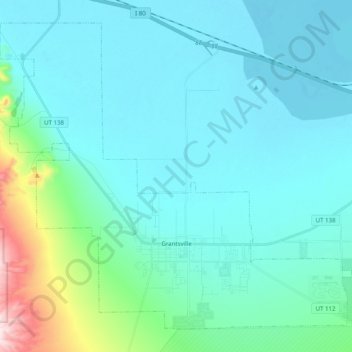
Name: Grantsville topographic map, elevation, terrain.
Location: Grantsville, Utah, 84029, United States of America (40.56337 -112.56321 40.69452 -112.36454)
Average elevation: 1,345 m
Minimum elevation: 1,278 m
Maximum elevation: 1,776 m