Geolocate

Zhanjiang City topographic map

Interactive map

Click on the map to display elevation.

About this map

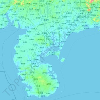
Name: Zhanjiang City topographic map, elevation, terrain.

Location: Zhanjiang City, Guangdong Province, China (20.20035 109.62433 21.95812 111.01341)

Average elevation: 23 m

Minimum elevation: -4 m

Maximum elevation: 1,171 m

Other topographic maps

Click on a map to view its topography, its elevation and its terrain.

凌塘村

China > Guangdong Province > Tianhe District

Average elevation: 47 m

Tangbei

China > Guangdong Province > Dongguan

Average elevation: 14 m

Boluo

China > Guangdong Province

Average elevation: 107 m

Shenzhen

China > Guangdong Province > Futian District > Shenzhen

Average elevation: 81 m

Beijin

China > Guangdong Province > Taishan > Jiangmen > Beijin

Average elevation: 19 m

Shalan

China > Guangdong Province > Jiangmen City > Shalan

Average elevation: 15 m