
Brünigpass topographic map
Interactive map
Click on the map to display elevation.
About this map
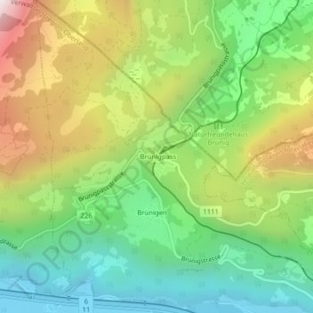
Name: Brünigpass topographic map, elevation, terrain.
Average elevation: 996 m
Minimum elevation: 575 m
Maximum elevation: 1,655 m
Der Brünigpass verbindet das Haslital im Berner Oberland (Kanton Bern) mit dem Sarneraatal im Kanton Obwalden. Er führt vom Berner Oberland (Hasliberg bzw. Brienzwiler und Meiringen) nach Lungern bzw. Giswil in Obwalden. Etwa 350 m nordöstlich der Passhöhe verläuft die Kantonsgrenze. Auf dem Pass liegt die Ortschaft Brünig, die zu Meiringen gehört.
Other topographic maps
Click on a map to view its topography, its elevation and its terrain.