Geolocate

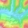
Tinthya topographic map

Click on the map to display elevation.

About this map

Name: Tinthya topographic map, elevation, terrain.

Location: Tinthya, Bhatwari, Uttarkashi, Uttarakhand, India (30.90571 78.61889 30.90581 78.61899)

Average elevation: 3,706 m

Minimum elevation: 2,974 m

Maximum elevation: 4,229 m

Other topographic maps

Click on a map to view its topography, its elevation and its terrain.

Kyarkoti Lake

India > Uttarakhand > Bhatwari

Average elevation: 4,043 m

Harsil

India > Uttarakhand > Bhatwari

Average elevation: 2,761 m

Pari Maatri Taal

India > Uttarakhand > Bhatwari

Average elevation: 4,443 m

Kedar Tal

India > Uttarakhand > Bhatwari

Average elevation: 4,814 m

Pulam Sumda

India > Uttarakhand > Bhatwari

Average elevation: 4,571 m

Gangotri Glacier

India > Uttarakhand > Bhatwari

Average elevation: 5,259 m

Dayara Bugyal

India > Uttarakhand > Bhatwari

Average elevation: 3,451 m

Kedar Tal

India > Uttarakhand > Bhatwari

Average elevation: 4,814 m

Kalindi Khal Area

India > Uttarakhand > Bhatwari

Average elevation: 5,857 m

Harsil

India > Uttarakhand > Bhatwari

Average elevation: 2,761 m

Gangotri Glacier

India > Uttarakhand > Bhatwari

Average elevation: 5,259 m

Gear up for your next adventure:

🌧️Rain Jackets - Waterproof jackets for hiking
🪢550 Survival Paracord - Versatile cordage for gear repair and emergency lashing
🔥Windproof Plasma Lighters - USB rechargeable lighters that work in high-altitude winds
🧼Biodegradable Soap - Eco-friendly outdoor soap
🧊Insulated Stainless Steel Flasks - Keep water cold for 24 hours in the heat or coffee hot in the cold

As an Amazon Associate, this site earns from qualifying purchases at no extra cost to you.