Geolocate

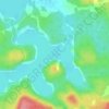
Christian Valley topographic map

Click on the map to display elevation.

About this map

Name: Christian Valley topographic map, elevation, terrain.

Location: Christian Valley, Nipissing Township, Parry Sound District, Central Ontario, Ontario, P0H 1W0, Canada (46.06997 -79.45503 46.07007 -79.45493)

Average elevation: 291 m

Minimum elevation: 200 m

Maximum elevation: 394 m

Other topographic maps

Click on a map to view its topography, its elevation and its terrain.
Gear up for your next adventure:

🦟Heavy Duty Insect Repellent - Essential protection against flies, mozzies, and march flies
🧰Survival Kits - Essential survival gear
🍴Titanium Spork & Cutlery - Indestructible and feather-light eating utensils
🥾Hiking Gaiters - Leg protection for trails
🧼Biodegradable Outdoor Soap - Clean gear and yourself without harming the local ecosystem

As an Amazon Associate, this site earns from qualifying purchases at no extra cost to you.