Geolocate

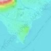
Zoverallo topographic map

Click on the map to display elevation.

About this map

Name: Zoverallo topographic map, elevation, terrain.

Location: Zoverallo, Verbania, Verbano-Cusio-Ossola, Piedmont, 28921, Italy (45.92696 8.55464 45.96696 8.59464)

Average elevation: 322 m

Minimum elevation: 189 m

Maximum elevation: 767 m

Other topographic maps

Click on a map to view its topography, its elevation and its terrain.
Gear up for your next adventure:

🧦Merino Wool Hiking Socks - Moisture-wicking socks to prevent blisters during long topographic surveys
🔌Fast Charging Adapters - Quickly top up all your gear before heading back into the field
🦟Heavy Duty Insect Repellent - Essential protection against flies, mozzies, and march flies
🧯Animal Deterrent Spray - Safety spray for wildlife
📚Map Reading & Navigation Guides - Master the art of interpreting topographic contours and symbols

As an Amazon Associate, this site earns from qualifying purchases at no extra cost to you.