Geolocate

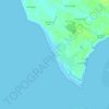
Chopdem topographic map

Click on the map to display elevation.

About this map

Name: Chopdem topographic map, elevation, terrain.

Location: Chopdem, Pernem, North Goa, Goa, 403512, India (15.61795 73.73478 15.65795 73.77478)

Average elevation: 24 m

Minimum elevation: -2 m

Maximum elevation: 92 m

Other topographic maps

Click on a map to view its topography, its elevation and its terrain.
Arambol Sweet Water Lake

India > Goa > Pernem > Arambol

Average elevation: 25 m

Morjim Beach

India > Goa > Pernem

Average elevation: 3 m

Gear up for your next adventure:

💧Personal Water Filters - Drink safely from streams and lakes identified on your map
📚Map Reading & Navigation Guides - Master the art of interpreting topographic contours and symbols
🧦Hiking Socks - Comfortable socks for long hikes
🔦LED Torches - LED torches for outdoor use
⌚Altimeter Watches - Watches with altitude tracking

As an Amazon Associate, this site earns from qualifying purchases at no extra cost to you.