
Casale sul Sile topographic map
Interactive map
Click on the map to display elevation.
About this map
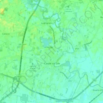
Name: Casale sul Sile topographic map, elevation, terrain.
Location: Casale sul Sile, Treviso, Veneto, 31032, Italy (45.57389 12.26419 45.63701 12.36020)
Average elevation: 6 m
Minimum elevation: 0 m
Maximum elevation: 16 m
Other topographic maps
Click on a map to view its topography, its elevation and its terrain.
Montebelluna
Montebelluna, Treviso, Veneto, 31044, Italy
Average elevation: 124 m
Brioni
Italy > Veneto > Treviso > San Vito di Altivole
Brioni, San Vito di Altivole, Altivole, Fonte, Treviso, Veneto, 31039, Italy
Average elevation: 83 m