
Krautsand topographic map
Interactive map
Click on the map to display elevation.
About this map
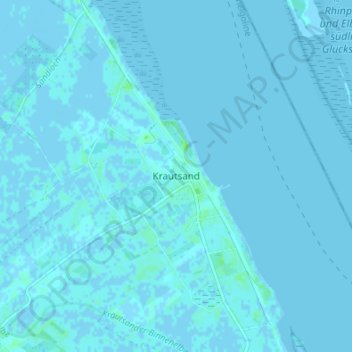
Name: Krautsand topographic map, elevation, terrain.
Average elevation: 0 m
Minimum elevation: -4 m
Maximum elevation: 6 m
Other topographic maps
Click on a map to view its topography, its elevation and its terrain.
Oberhüll
Deutschland > Niedersachsen > Landkreis Stade > Drochtersen > Hüll
Oberhüll, Hüll, Drochtersen, Landkreis Stade, Niedersachsen, 21712, Deutschland
Average elevation: 0 m
Asselermoor
Deutschland > Niedersachsen > Landkreis Stade > Drochtersen
Asselermoor, Drochtersen, Landkreis Stade, Niedersachsen, 27214, Deutschland
Average elevation: 0 m