
Coșevița topographic map
Interactive map
Click on the map to display elevation.
About this map
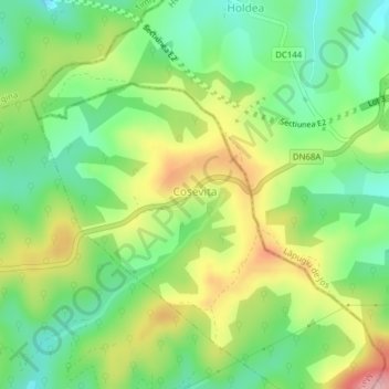
Name: Coșevița topographic map, elevation, terrain.
Location: Coșevița, Margina, Timiș, 307263, Roumanie (45.87672 22.37902 45.88013 22.38958)
Average elevation: 306 m
Minimum elevation: 243 m
Maximum elevation: 401 m
Other topographic maps
Click on a map to view its topography, its elevation and its terrain.