
Polanica-Zdrój topographic map
Interactive map
Click on the map to display elevation.
About this map
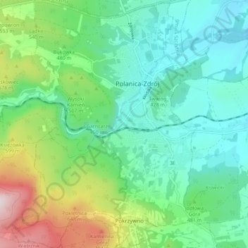
Name: Polanica-Zdrój topographic map, elevation, terrain.
Location: Polanica-Zdrój, powiat kłodzki, Basse-Silésie, 57-320, Pologne (50.37182 16.46773 50.42597 16.53121)
Average elevation: 471 m
Minimum elevation: 334 m
Maximum elevation: 836 m