
Eresried topographic map
Interactive map
Click on the map to display elevation.
About this map
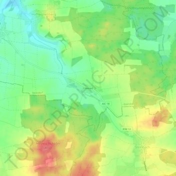
Name: Eresried topographic map, elevation, terrain.
Average elevation: 559 m
Minimum elevation: 526 m
Maximum elevation: 601 m
Other topographic maps
Click on a map to view its topography, its elevation and its terrain.
Steindorf
Deutschland > Bayern > Landkreis Aichach-Friedberg > Steindorf
Steindorf, Mering, Landkreis Aichach-Friedberg, Bayern, 82297, Deutschland
Average elevation: 547 m