Geolocate

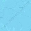
Steggerda topographic map

Click on the map to display elevation.

About this map

Name: Steggerda topographic map, elevation, terrain.

Location: Steggerda, Weststellingwerf, Frisia, Netherlands (52.83870 6.04665 52.88336 6.12099)

Average elevation: 2 m

Minimum elevation: -2 m

Maximum elevation: 10 m

Other topographic maps

Click on a map to view its topography, its elevation and its terrain.
Leeuwarden

Netherlands > Frisia > Leeuwarden

Average elevation: 0 m

Vierhuizen

Netherlands > Frisia > Allingawier

Average elevation: -2 m

Oost-Vlieland

Netherlands > Frisia

Average elevation: 2 m

Kooiplaats

Netherlands > Frisia > Buren

Average elevation: 1 m

Loënga

Netherlands > Frisia > Loënga

Average elevation: 0 m

Gear up for your next adventure:

🪑Portable Backpacking Chairs - A comfortable seat for studying maps at the end of the day
🧯Animal Deterrent Spray - Safety spray for wildlife
🏫Topographic World Globes - 3D physical relief globes to understand global geography
⌚Altimeter Barometer Watches - Outdoor watches with built-in sensors to track altitude changes and weather shifts
💡Collapsible Camping Lanterns - Illuminate your base camp or tent for map studying at night

As an Amazon Associate, this site earns from qualifying purchases at no extra cost to you.