Geolocate

Bukuya topographic map

Interactive map

Click on the map to display elevation.

About this map

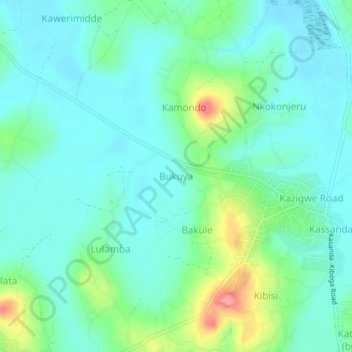
Name: Bukuya topographic map, elevation, terrain.

Location: Bukuya, Kassanda, Central Region, Uganda (0.65861 31.79972 0.69861 31.83972)

Average elevation: 1,173 m

Minimum elevation: 1,147 m

Maximum elevation: 1,257 m

Other topographic maps

Click on a map to view its topography, its elevation and its terrain.

Kibisi

Uganda > Kassanda

Kibisi, Kassanda, Central Region, Uganda

Average elevation: 1,181 m

Myanzi

Uganda > Kassanda

Myanzi, Kassanda, Central Region, Uganda

Average elevation: 1,194 m

Dwaliro

Uganda > Kassanda

Dwaliro, Kassanda, Central Region, Uganda

Average elevation: 1,215 m