
Thank you for supporting this site ❤️
Make a donation
Make a donation
Gear up for your next adventure:
As an Amazon Associate, this site earns from qualifying purchases at no extra cost to you.
Yalaha topographic map
Click on the map to display elevation.
Thank you for supporting this site ❤️
Make a donation
Make a donation
Gear up for your next adventure:
As an Amazon Associate, this site earns from qualifying purchases at no extra cost to you.
About this map
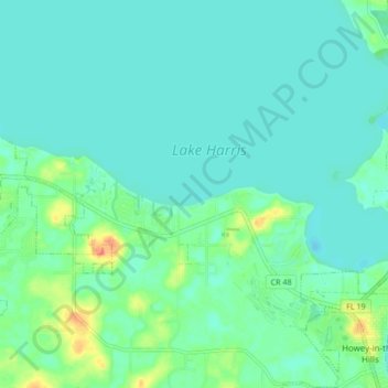
Name: Yalaha topographic map, elevation, terrain.
Location: Yalaha, Tavares, Lake County, Florida, 34797, United States (28.71038 -81.86304 28.78446 -81.78033)
Average elevation: 24 m
Minimum elevation: 14 m
Maximum elevation: 59 m
Thank you for supporting this site ❤️
Make a donation
Make a donation
Gear up for your next adventure:
As an Amazon Associate, this site earns from qualifying purchases at no extra cost to you.