
Quebrada de Yanganuco topographic map
Interactive map
Click on the map to display elevation.
About this map
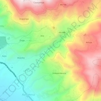
Name: Quebrada de Yanganuco topographic map, elevation, terrain.
Location: Quebrada de Yanganuco, Ranrahirca, Yungay, Áncash, Perú (-9.17610 -77.73424 -9.13107 -77.69035)
Average elevation: 2,839 m
Minimum elevation: 2,417 m
Maximum elevation: 3,341 m
Other topographic maps
Click on a map to view its topography, its elevation and its terrain.
Provincia de Yungay
Perú > Áncash > Ranrahirca
Provincia de Yungay, Ranrahirca, Yungay, Áncash, Perú
Average elevation: 3,186 m