Geolocate

Dronfield topographic map

Click on the map to display elevation.

About this map
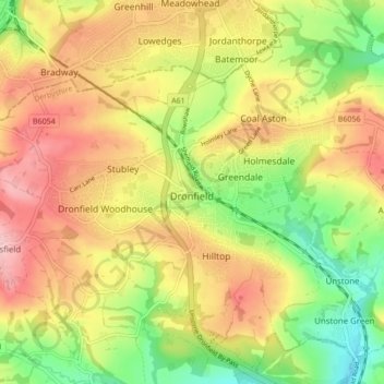
Name: Dronfield topographic map, elevation, terrain.

Location: Dronfield, North East Derbyshire, Derbyshire, East Midlands, England, United Kingdom (53.28306 -1.52636 53.32186 -1.44082)

Average elevation: 167 m

Minimum elevation: 79 m

Maximum elevation: 252 m

Other topographic maps

Click on a map to view its topography, its elevation and its terrain.

Gear up for your next adventure:

🛰️Handheld GPS Units - Rugged GPS devices for tracking coordinates and elevation in the Australian bush
🧣Merino Neck Gaiters - Versatile headwear for warmth, sun protection, or dust filtering
🎒Daypacks - Compact backpacks for short hikes
🧭Global Orienteering Compass - High-precision liquid-filled compasses for accurate map reading and navigation
👟Lightweight Trail Runners - Agile footwear for fast movement over rugged Australian terrain

As an Amazon Associate, this site earns from qualifying purchases at no extra cost to you.