Geolocate

Blucher topographic map

Click on the map to display elevation.

About this map
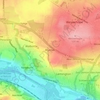
Name: Blucher topographic map, elevation, terrain.

Location: Blucher, Newcastle upon Tyne, North of Tyne, England, NE15 9SH, United Kingdom (54.97057 -1.74439 55.01057 -1.70439)

Average elevation: 68 m

Minimum elevation: -3 m

Maximum elevation: 133 m

Other topographic maps

Click on a map to view its topography, its elevation and its terrain.

Gear up for your next adventure:

🧊Insulated Stainless Steel Flasks - Keep water cold for 24 hours in the heat or coffee hot in the cold
🧤Thermal Hiking Gloves - Keep your hands warm and functional during high-altitude winter treks
🕶️Polarized Sunglasses - UV protection sunglasses for outdoors
🧼Biodegradable Soap - Eco-friendly outdoor soap
🦶Orthotic Hiking Insoles - Extra arch support for long-distance topographic treks

As an Amazon Associate, this site earns from qualifying purchases at no extra cost to you.