
Guillerville topographic map
Interactive map
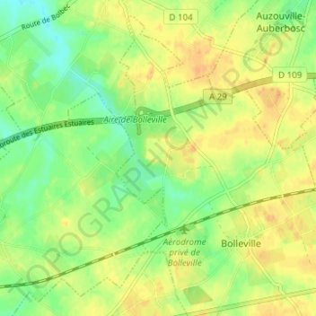
Click on the map to display elevation.
About this map
Name: Guillerville topographic map, elevation, terrain.
Average elevation: 139 m
Minimum elevation: 123 m
Maximum elevation: 151 m
Other topographic maps
Click on a map to view its topography, its elevation and its terrain.
Le Bocage
France > Normandie > Seine-Maritime > Bolleville > Le Bocage
Le Bocage, Bolleville, Le Havre, Seine-Maritime, Normandie, France métropolitaine, 76210, France
Average elevation: 145 m